AEF Mosaic
A global mosaic of Google AlphaEarth Foundations Satellite Embeddings, covering 2017-2025 at ~0.00009° resolution. The dataset is projected in EPSG:4326 with a fixed pixel size in degrees. This means that pixels cover ~10m on the ground at the equator, but less area at higher latitudes. For area-based analysis, consider reprojecting to an equal-area projection, creating your own mosaic in a custom CRS, or using the underlying COGs which are already projected to UTM. This copy is not officially supported by Google.
This dataset implements the following Zarr conventions. These Zarr conventions are not mature and may change.
License
This dataset is licensed under CC-BY 4.0 and requires the following attribution text: "The AlphaEarth Foundations Satellite Embedding dataset is produced by Google and Google DeepMind."
Visualizations
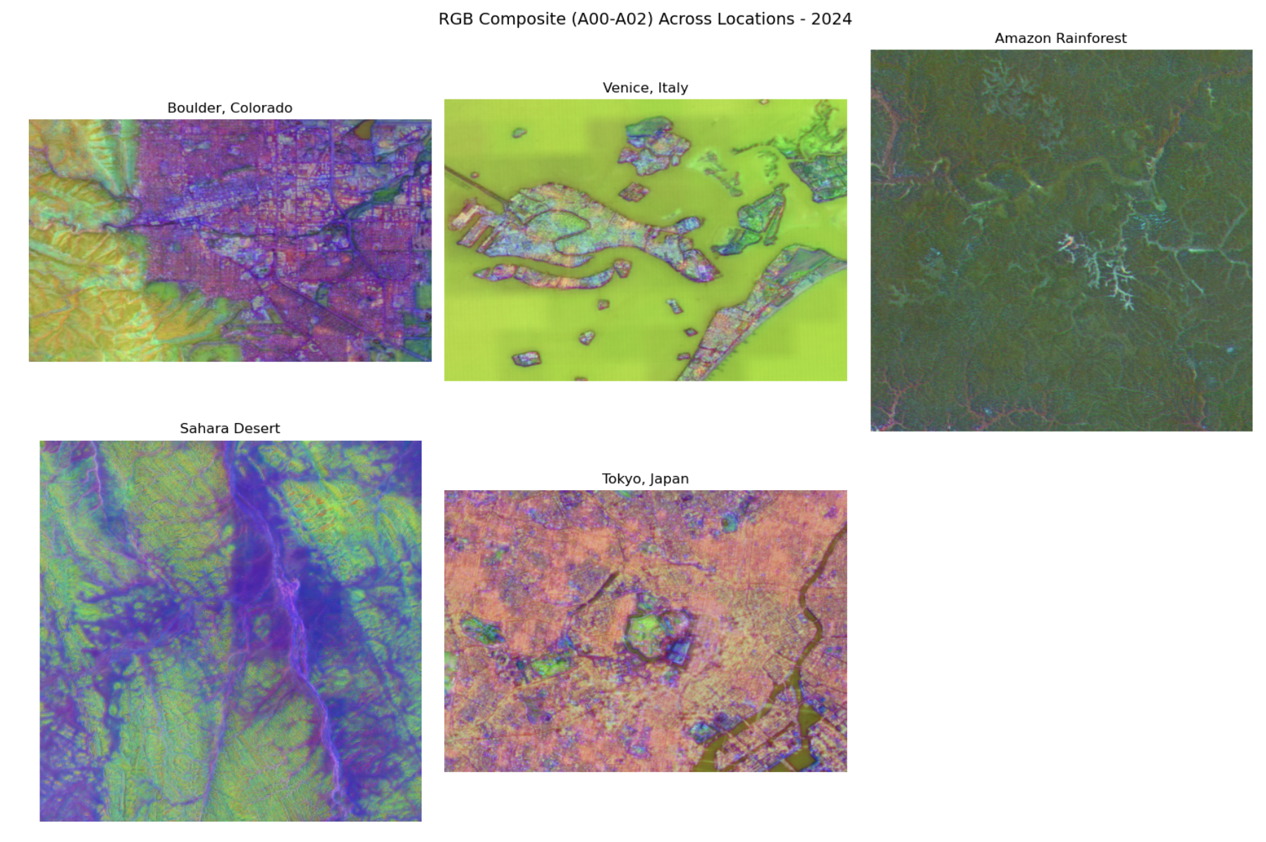
RGB Composite
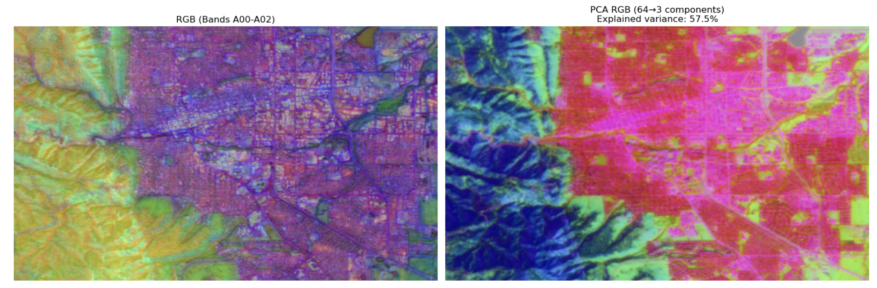
PCA visualization of the embedding space projected to RGB:
RGB PCA (Zoomed)
Detailed view showing embedding structure at higher resolution:
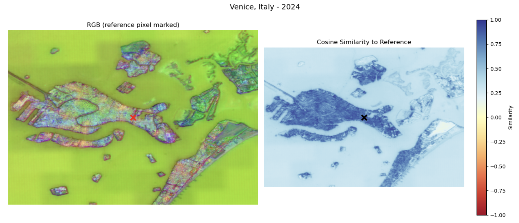
Cosine Similarity
Similarity search using a query embedding:
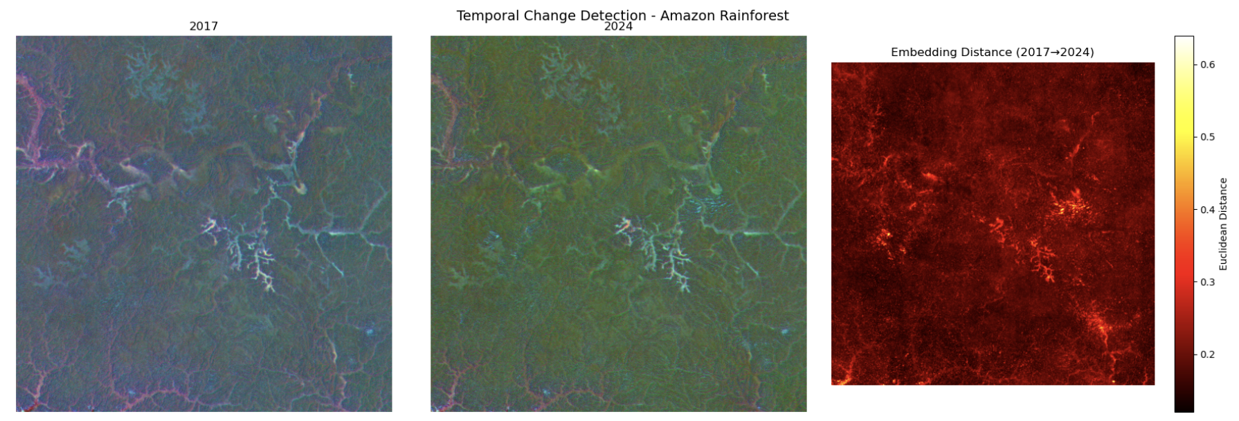
Change Detection
Temporal embedding differences highlighting landscape changes:
Quick Start
Xarray
Zarr-python
Dataset Details
Source Code
The processing pipeline used to create this mosaic is available at: https://github.com/geospatial-jeff/aef-mosaic
Contact
Please send any comments, questions, or points of feedback to the #opening-aef CNG slack channel.